Identity, Equity, & Growth
A holistic urban renewal and development proposal for an underserved inner-city neighborhood in San Antonio, Texas.
Master’s Thesis - Politecnico di Milano - 2019
In the next 20 years, San Antonio, Texas is projected to grow by 1 million people, ranking it the third fastest growing city in the United States. Facing its largest growth spurt yet, the city continues to expand outward, sprawling north and northwest into the Texas Hill Country. Residents are fleeing to the suburbs due to cheaper real estate prices, leaving lower income residents in central areas. Due to this influx and years of historic racial segregation, San Antonio is considered one of the most economically segregated cities in the country today. The inner-city area just west of Downtown, called the Near Westside, is the most affected by economic segregation and has the highest poverty levels in the city along with low-education levels. Though the area is located a few miles from tourist destinations such as the Alamo, Riverwalk and Pearl Brewery, it has a sprawling, fragmented, and degraded landscape. With its proximity to Downtown, it is only a matter of time before the Near Westside will be a target for development.
The following proposal attempts to understand the current obstacles on the Near Westside and suggest holistic solutions for equitable growth by considering the existing identity of the built landscape and the people who live there.
The following proposal attempts to understand the current obstacles on the Near Westside and suggest holistic solutions for equitable growth by considering the existing identity of the built landscape and the people who live there.


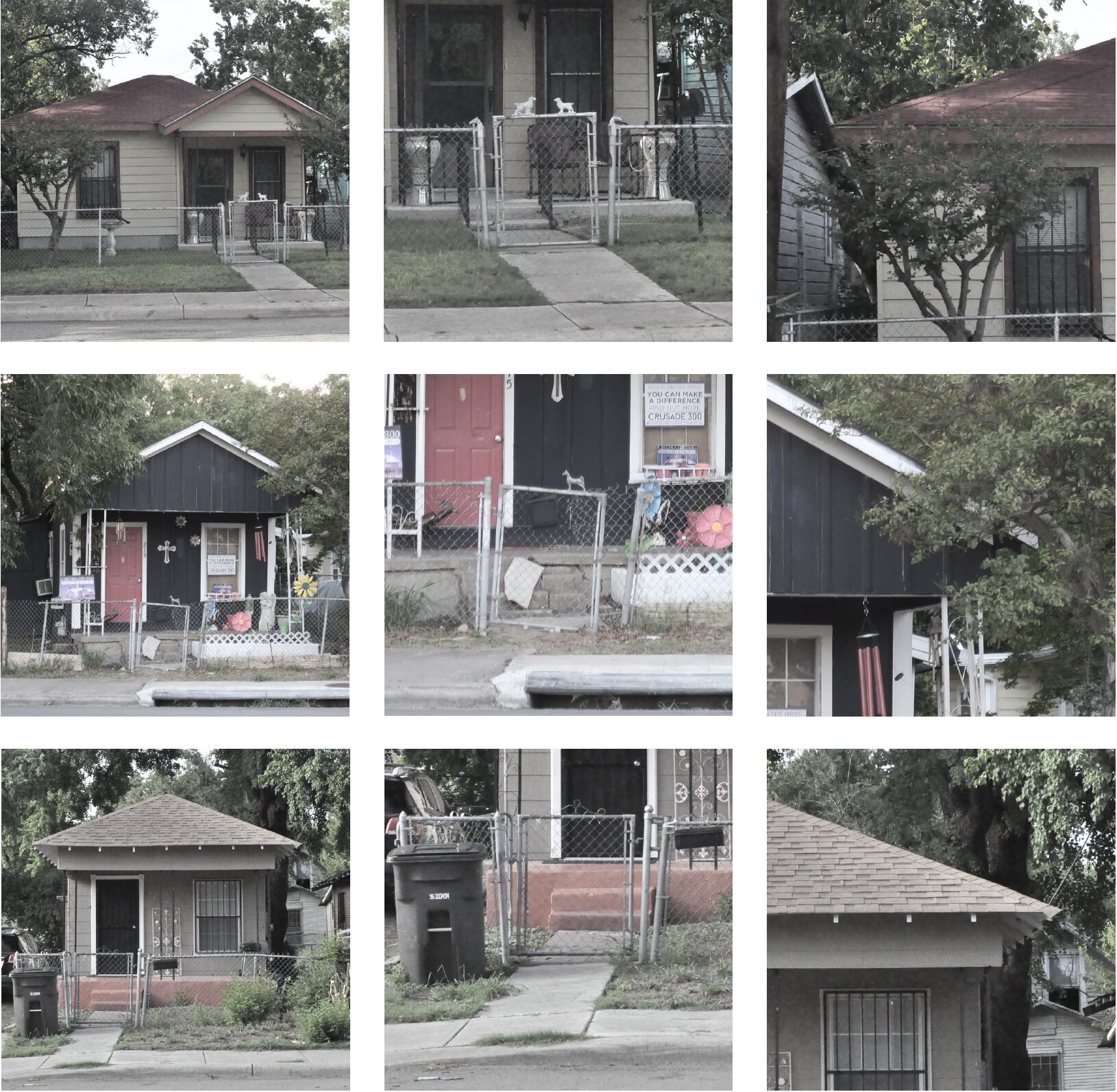
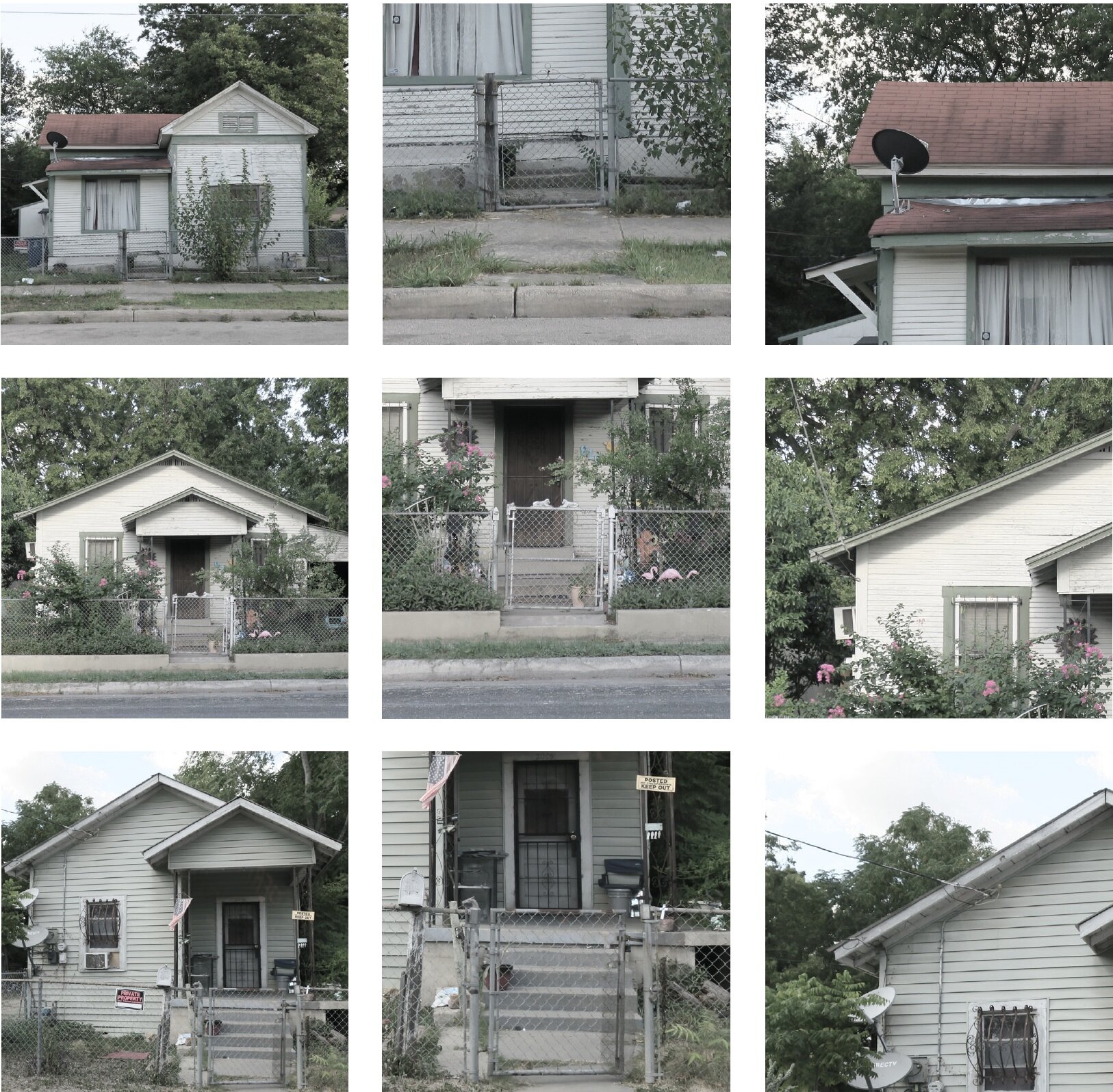
Mapping the landscape
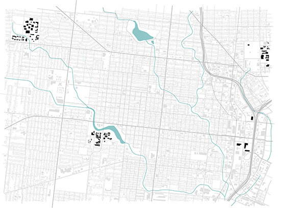
The following mapping highlights the physical character and spatial quality of the Near Westside’s landscape. Like many post-war North American cities, the Near Westside is heavily characterized by land-use zoning. Three clear categories are defined within the urban area: industrial, commercial, and residential. The industrial zones are clustered to the East along the railway line and near the Interstate highways for logistical purposes.
The commercial zones are placed along main arteries and busier thoroughfares. The
residential zones are characterized by detached, single-family houses and make up the vast majority of the built landscape. This clear differentiation of land-use and heavy emphasis on privately- owned, single-family houses has produced a fragmented, car-centric, diffused landscape, more closely resembling suburbia than an urban setting.
Below from left to right: Industrial Zone, Commercial Zone, Single-Family Residential, Multi-Family Residential, Non-Profit and Religious Facilities, Universities.

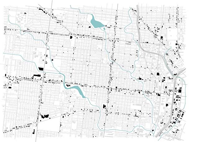

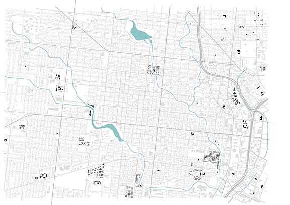

Identifying Systems
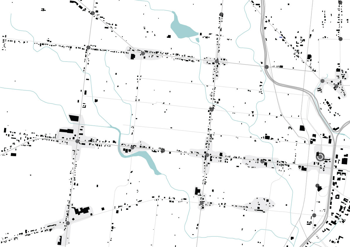
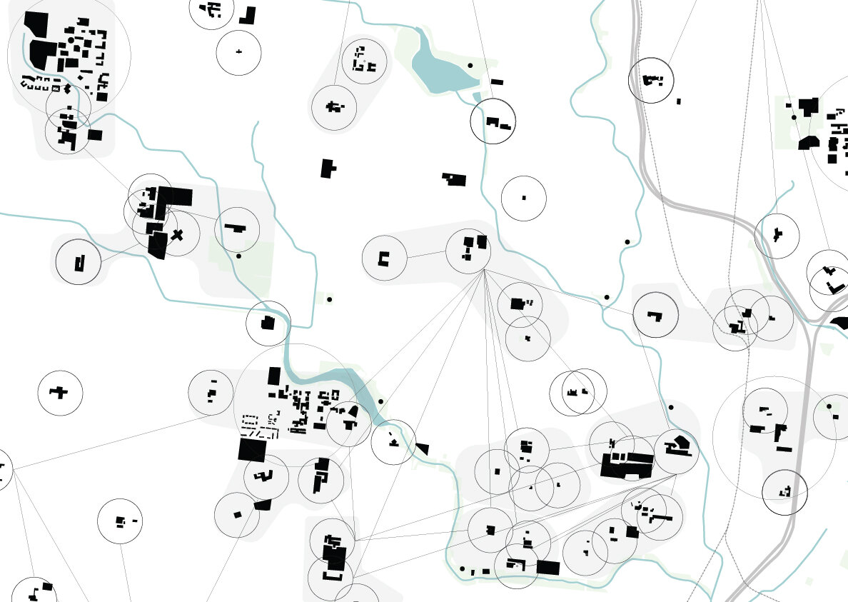
The below maps dive deeper by defining existing systems. These systems illustrate concentrations of natural ecosystems, businesses, and cultural buildings already existing on the Near Westside. They are the existing framework on which to build, and have the potential to play an important role in regenerating the area.
The maps are organized into three main categories: ecological, economic, and cultural systems. The ecological system map includes the existing waterways, bike paths,
public parks, playgrounds, and green oddments. The economic system map includes concentrations of businesses, public transportation stops, and the multi-modal transportation hub. Lastly, the cultural system map includes clusters of schools, libraries, and universities. The schools are mapped in relation to each other - i.e. the set of schools a child would attend through elementary, middle, and high school.- along with their proximity to playgrounds and parks.
Below from left to right: Ecological Systems, Economic Systems, and Cultural Systems

Superimposed System
After identifying the existing systems, the maps are overlaid to discover activation points and future centralities. Acting as the initial spark, these centralities are the powerful starting points for regeneration and will provide the most effective, beneficial, and holistic change to the community.
The base map is the existing landscape with major defining characters such as the
waterways, highway and railroad. The next map is the ecological systems and is made up of a combination of new neighborhood parks, bike paths, and wetlands. The next map is the economic systems map showing concentrations of businesses followed by the cultural systems map with schools, universities, and libraries clusters. The final map pinpoints future centralities by identifying where each system overlaps.
Confluence
The following design proposal acts as an example work of what an urban centrality could be. The guiding principle of the design is to create social and spatial unity in a divided and fragmented landscape. Public space is a priority within the design to encourage social cohesion. The goal is to provide public space for unity to manifest; quality spaces adapted to the human scale where one can socialize, play, sell goods, learn, and explore. These spaces must be flexible, high quality, and diverse for the local community to enjoy. They must be spaces that would invite people to remain there. By their nature, parks, cultural/sports facilities, and playgrounds are among the main elements that provide space and structure for a community’s social life.
The chosen site is in an area previously mapped as an urban centrality - where the ecological, economical, and cultural nodes currently overlap. It is located in a crucial
area near the “gateway”, just west of Downtown and the Near Westside’s industrial zone, with close proximity to the new bus terminal. Two major thoroughfares - West Commerce and Buona Vista Street - run East/West through the area with businesses and parking lots scattered along their edges. These one-way streets currently have local bus lines and will soon provide stops for the larger BRT bus line. Alazan Creek runs parallel to the thoroughfares and cuts off the many residential streets. It’s expansive buffer collects trash and debris. Near the creek, a large abandoned lot sits in between West Commerce and Buena Vista Street. The site has remnants of a past building or parking lot. Two houses and a coffee roasters currently inhabit the southern edge of the site near the creek. On the opposite side, these is a third house, a gas station with convenience store, and a small park.
The guiding principle of the design is to create social and spatial unity in a divided and fragmented landscape. Public space is a priority within the design to encourage social cohesion. The goal is to provide public spaces for unity to manifest; quality spaces adapted to the human scale where one can socialize, play, sell goods, learn, and explore.
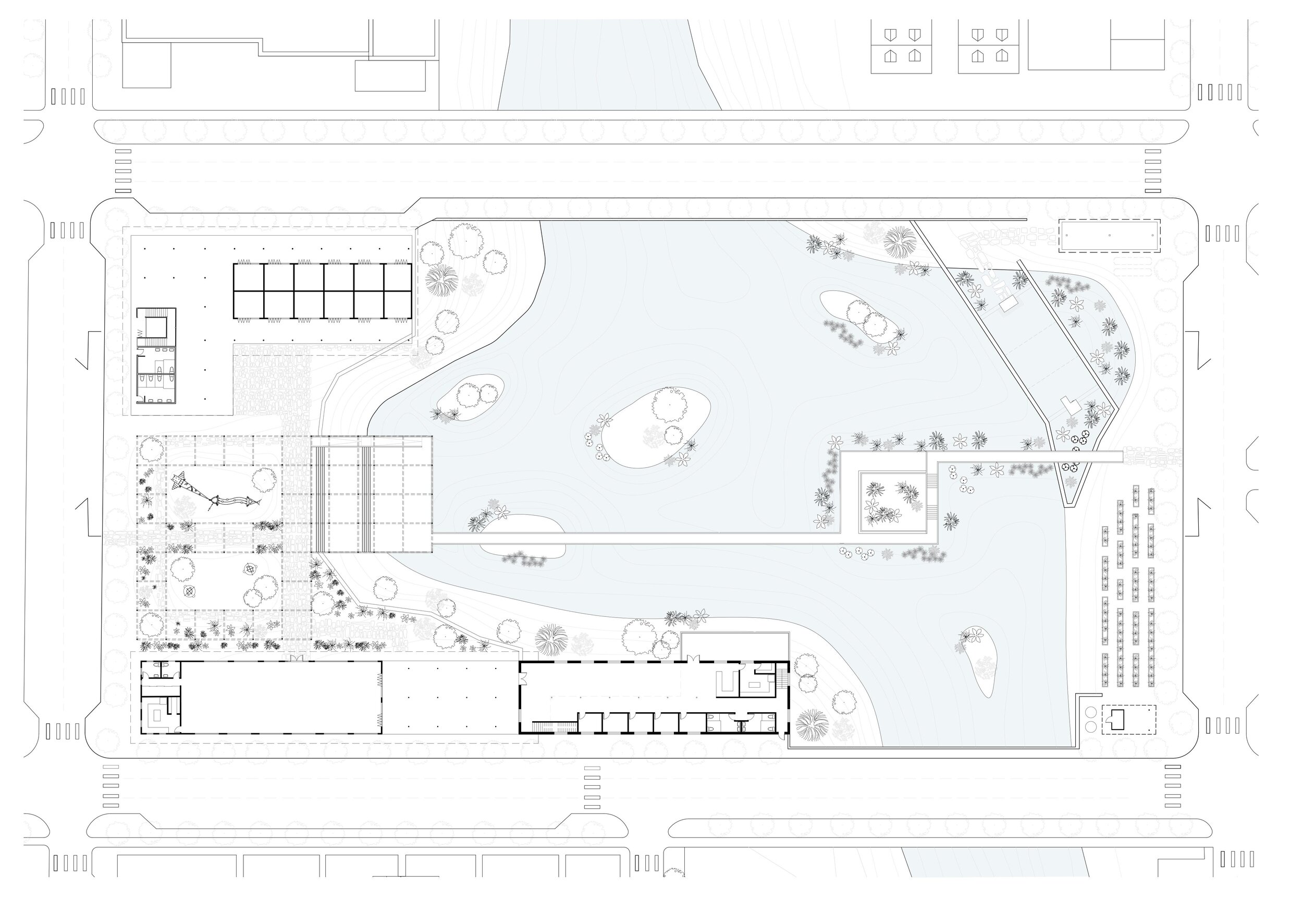
The design proposal is organized into five recognizable spaces: the open market in the northwest corner, the canopy with playground, entertainment deck, and bridge in the central axis, the community center and co-working café in the southwest corner, the natural swimming pool in the northeast corner, and the community garden in the southeast corner. The built structures in the corners of the site act as pillars and provide a visual boundary, containing the interior space of the site.
The open market and community center were placed strategically on the west side of the creek due to their proximity to existing businesses and the public transit stop. Diversely, the softer, more natural functions such as the swimming pool and community garden are located on the east side of the creek extending into the residential housing blocks. The design proposal is intended to take place incrementally over a course of time. Incremental transformation encourages equitable and resilient growth. It allows for changes to be made during the transformation process assuring refined results.
The design proposal is organized into five recognizable spaces: the open market in the northwest corner, the canopy with playground, entertainment deck, and bridge in the central axis, the community center and co-working café in the southwest corner, the natural swimming pool in the northeast corner, and the community garden in the southeast corner.
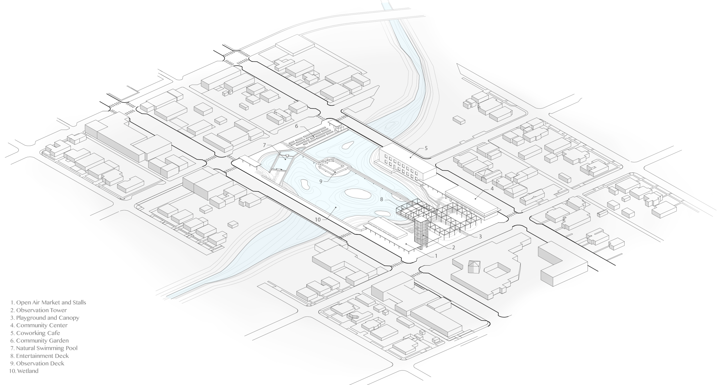
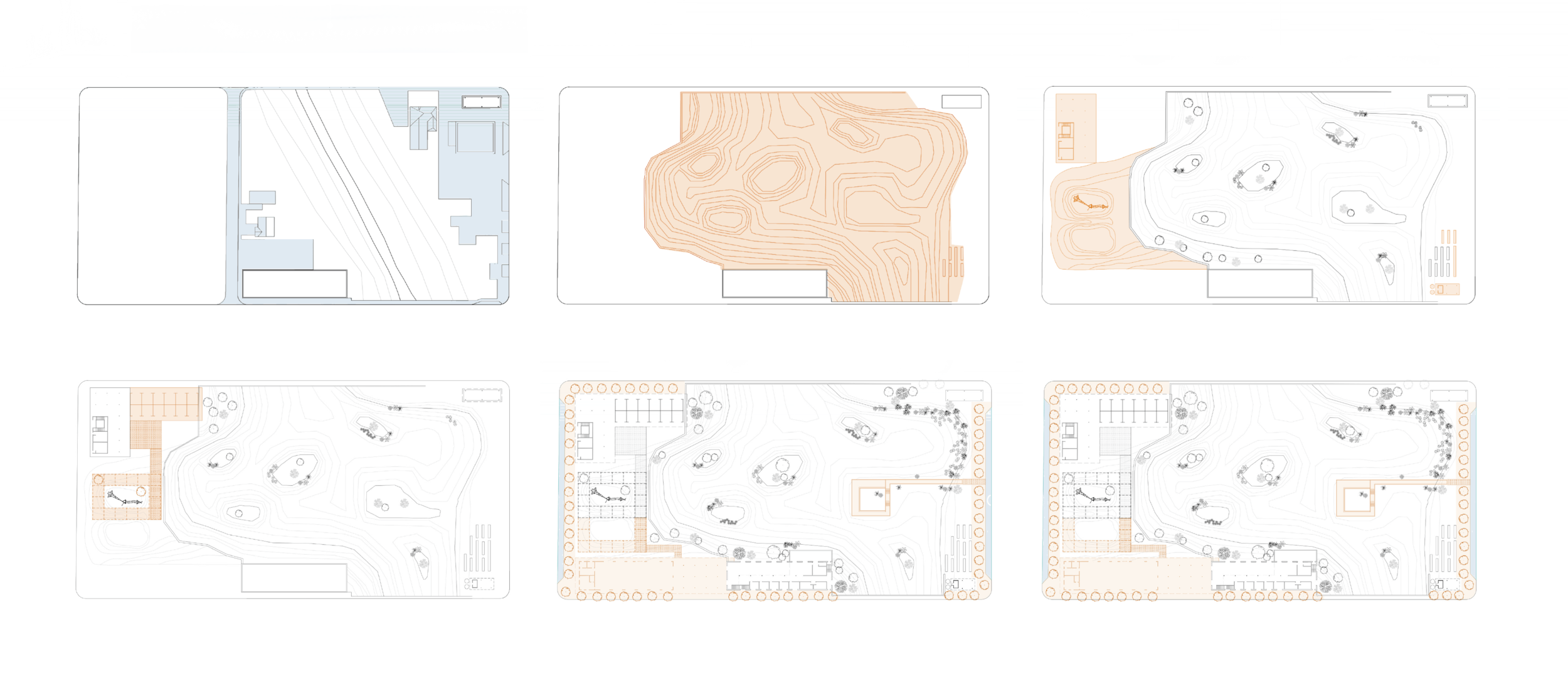
The diagrams below illustrate the phases that could take place to realize the design proposal. Phase I includes the relocation of three existing houses and removal of the side street, gas station convenience store, and paved terrain. Phase II includes the excavation of the creek, construction of retaining walls, and beginning stages of the community garden. Phase III includes the forming of the playground earth mounts, expansion of the community garden, beginning construction of the open market/observation tower, and the addition of the playground. Phase IV includes the extension of the open market with permanent stalls and the addition of the light-frame canopy system.
Phase V includes the removal of the street curb for parking access and the construction of the community center, wetland observation deck, and streetscape design. The last phase, phase VI, includes the expansion of the community garden and construction of the entertainment deck and natural pool.
Phases I through VI may take place over a course of 15 years or even longer. The actors involved in a project and the overall resource availability will determine the general time frame of a specific phase.
The proposal is intended to take place incrementally over a course of time to encourage equitable and resilient growth. It allows for changes to be made during the transformation process assuring refined results.
